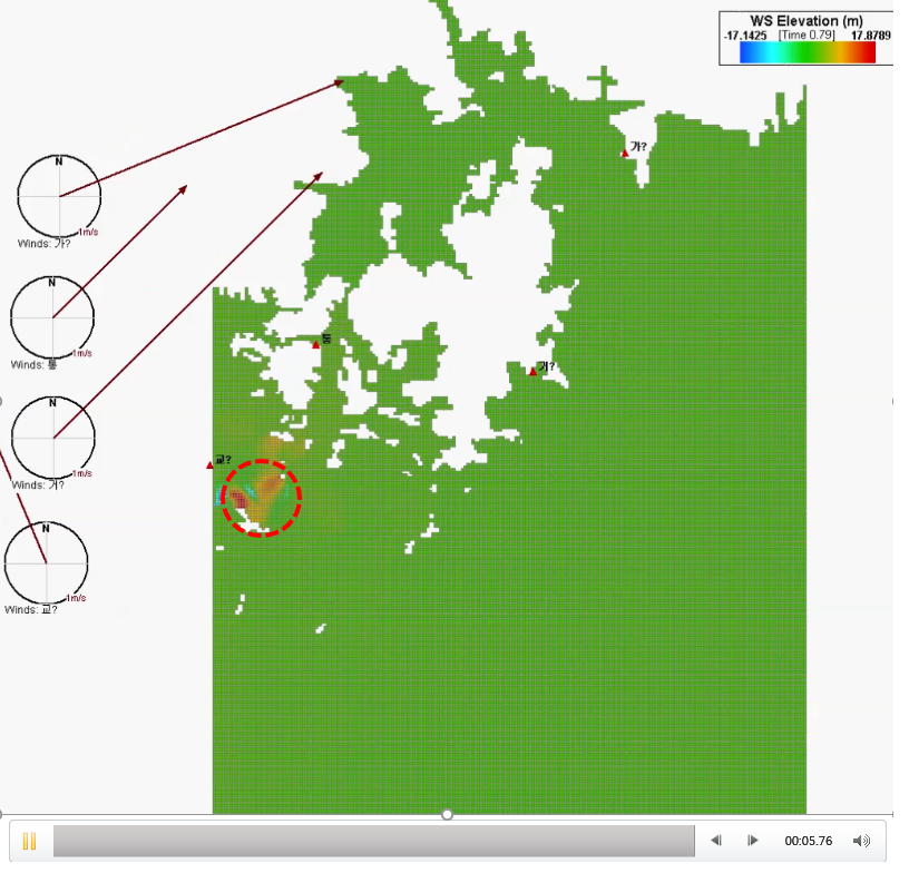
Dear all, I got simulation result of water surface elevation in a coastal region. I used three open boundary conditions (west, east, and south). In my simulation, I had unexpected increase in water surface elevation in a specific area. Please take look at the picture in the presentation file attached. In the red-dotted circle, very high water surface elevation was observed in the red-dotted circle. The high water surface elevation was maintained until finishing the simulation. What kind of problems are involved in the simulation? Thank you for considering. All the best Yongeun Attached files 
Looking at the image you sent there appears to be model instability in the region where there is very high WSEL. We would need to see the model to determine the exact cause. If the high WSEL occurs from the start of the model run it is likely to be the initial conditions, so check the bathymetry and bed roughness at that area. If this issue starts later in the run we recommend you try lowering the time step and see if that improves it. Also, note that you can change the scale of the wind timing frames with the scale option shown in figure 3 here: https://eemodelingsystem.atlassian.net/wiki/display/EEREF/Boundary+Groups+Tab
Hello everyone,
I have exactly the same problem with high water surface elevations in a specific area.
Could you comment more about this problem and how is it solved?
Thanks!
Frank