Dear Grid+ Support Team,
I hope you are doing well.
I have a question regarding the use of Grid+.
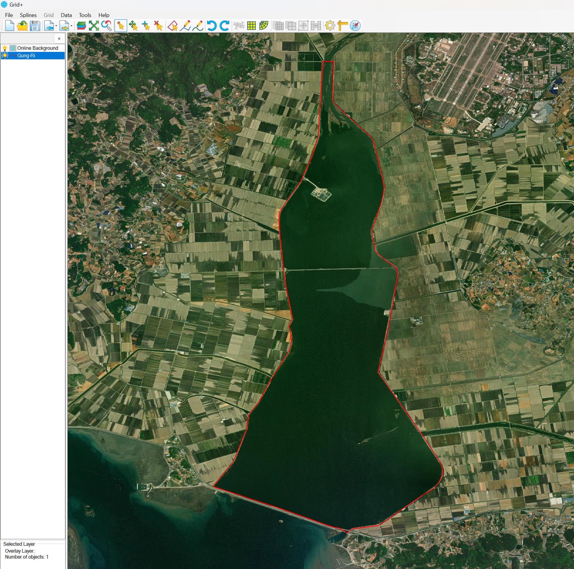
In my research, the estuary I am focusing on is located as shown in the first figure.
However, the grid previously created by a colleague, as illustrated in the second figure, does not align with the correct coordinates when imported into Grid+.
I would like to confirm whether it is possible to shift the grid within Grid+ to match the intended location, or if it is necessary to generate a new grid from scratch to achieve proper alignment.
I would greatly appreciate any guidance you could provide on this matter.
Thank you in advance for your support.
Best regards,
Jaeyoung An
Hi Jaeyoung An,
The Grid+ works by default with the Lat, Long coordinate system. However, it is fine as well if you have a shoreline for your study area in the UTM coordinate.
So firstly you can create the shoreline from Google Earth software, you can generate a polygon for your area. Next, you can save that polygon from GE to a KML or KMZ file. Next, open Grid+, load that KML or KMZ file by using import an overlay file feature in Grid+. Now you can zoom in on the layer by using the option from the right mouse click. It will be located at the right location on the online map. If your KML file generated in UTM coordinate, you need to define projection for it by selecting that file layer and right mouse click, then select Properties/Coordinate System/Define then choose proper projection for your area then click OK button. After that you can start generating grid.
For your existing grid from a colleague, you need to check its projection. I assume that its projection is not in Lat, Long. So you may need to define its projection when importing it into Grid+. If it’s ok you can send us your grid. We will support you.
I hope the explanation here is helpful for you.
Regards,
Duy Pham
Dear Duy,
Hello, and thank you for your response.
I am currently using EE 11.8 DEMO MODE.
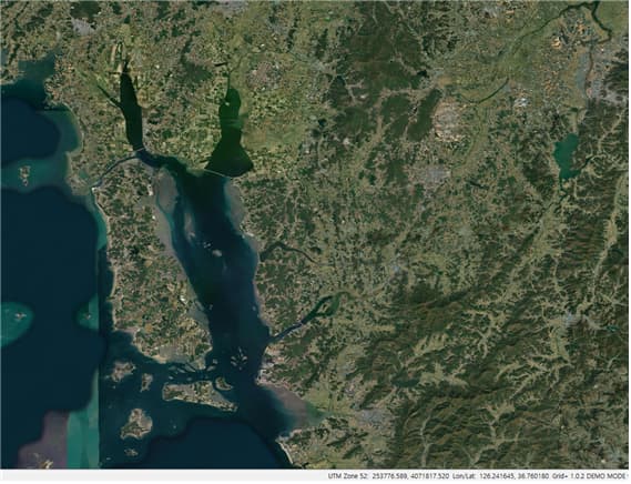
First, I would like to share an image of the existing grid file.

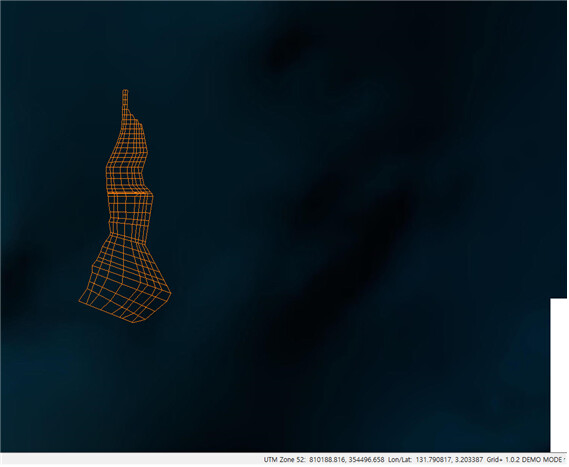
I attempted to modify the coordinates by opening the .gpc file of this grid in a text editor and then reloading it in Grid+ and EFDC+. However, as you can see in the attached second image, the grid lines appear significantly distorted compared to the original. Additionally, they do not align properly with the estuarine reservoir located immediately to the right.

I would like to send you the .gpc file corresponding to the first and second image for your reference. I also plan to include the currently running EFDC+ file, as I previously input data such as flow rate, salinity, and wind speed. I would like to confirm whether these data will be correctly transferred along with the grid.
Could you please share your email address so I can send the files?
I would appreciate your guidance on this matter.
Thank you in advance for your support.
Best regards,
Jaeyoung An
Hi Jaeyoung An,
I am sorry, but I can’t see your attached images. I attached an image to show shoreline here, which covers your study area. I created this file using the Geographic coordinate system (Lat, Long) from Google Earth. You can select “Decimal Degress” from Tools in GE and generate the shoreline, then load it into Grid+, which version is accompanied by EEMS11.8. When you load it, a form will pop up to define projection (as a file in the Geographic coordinate system, so you need to select proper projection). And then you can start generating grid. After you finish generating grid, you need to save/export grid to a file (*.gpc). Then, you open EE11.8 to import that grid file. Please note as you are using the Demo version Grid+ will limit the number of grid cells. After you import the grid file into EE11.8, you can start setting up the model by adding flow, salinity, and wind boundary conditions.
Regards,
Duy Pham
https://eemodelingsystem.atlassian.net/wiki/spaces/CVLGRID/overview
https://eemodelingsystem.atlassian.net/wiki/spaces/EK/pages/240255075/Generating+a+New+Model