Hi! This is my first time using EFDC to model a river. However I can’t figure out why my spatially-varying initial water surface elevation assignment doesn’t seem to affect my simulation results.
Environment: EE 12.4.1, Release 251028
What I did:
- In Model Control → Initial Conditions → Water Depth/Elevation, I opened “Assign Elevation” dialog
- Selected “All grid cells” + “Scatter (XYZ) data” + “Centroid Interp.”
- Loaded a scatter data file (X, Y, Z columns, 684 points matching my 684 grid cells) via Data Files → Add File
- Clicked “Apply Defined Conditions” — got confirmation popup: “Modified 684 cells in a time of 00:00:00.071!”
- Clicked OK on both dialogs, then Save Model (Ctrl+S)
What I confirmed worked:
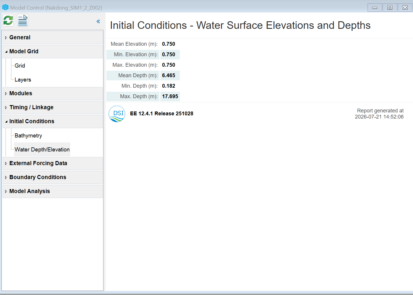
- Using 2DH View → Bottom Elevation layer + info tool, I manually inspected individual floodplain cells (e.g., I=3,J=3, Bot EL 3.0002) and confirmed Depth changed from the old uniform value to 0.001 m — so the spatial assignment did seem to apply at the cell level.
The problem:
- After re-running the 31-day calibration simulation, the Error Statistics Report (RMSE, NSE) and the Station_1 time-series output are IDENTICAL (to 3 decimal places) to my previous run with uniform initial WSEL. RMSE = 0.054, NSE = -4.734, unchanged.
- This suggests the solver isn’t actually using my new spatially-varying WSEL as the initial condition at simulation start, even though the GUI showed it was applied.
Question: Is there a separate setting (e.g., a Hot Start/Restart file option under Timing/Linkage) that could be overriding my manually-assigned Initial Condition? Or is there an additional step needed (beyond Save Model) to make sure the solver picks up the new IC before running? Any guidance appreciated!
(attached: summary of initial conditions generated after inputting the water elevation)