Using the EE7.3 questions, I want to receive your advice so I’ve in contact.
1.I wonder if I can enter the wind data as each grid.
2.I wonder if I can enter the ocean current data from open the boundary conditions. because my study area are maybe affected by Kuroshio current(or yellow warm current)
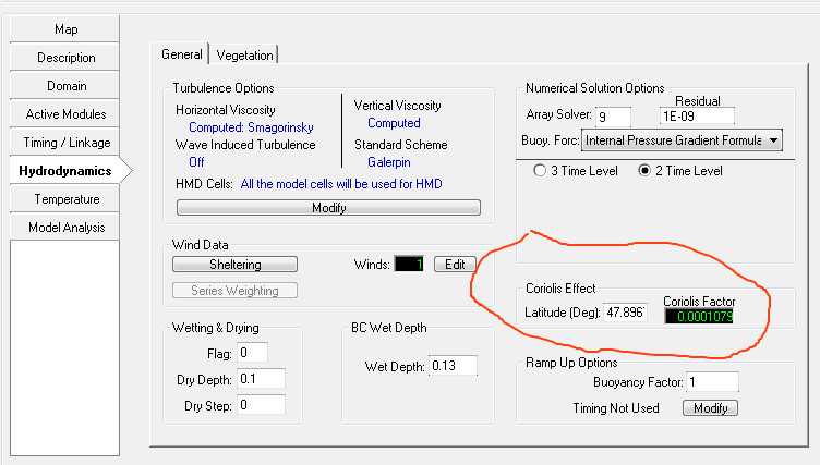
3.I wonder if I can enter the CORIOLIS PARAMETER as each grid and ZROUGH depending on the depth
Hi, Please see responses to your questions below.
1.I wonder if I can enter the wind data as each grid.Not sure why you want to enter the wind data at each grid. EFDC will internally use the wind data and apply to all the cells in the model. So, if you have wind data at more than one location then you can use those data and assign them in the model applying series weighting temporally or spatially.
2.I wonder if I can enter the ocean current data from open the boundary conditions. because my study area are maybe affected by Kuroshio current(or yellow warm current)Did you mean velocities as boundary condition ? Currently, you can use either tide (harmonic series) or water surface elevation or flows as boundaries. You can use water surface elevation or tides as boundary condition and use current data as your calibration data.
3.I wonder if I can enter the CORIOLIS PARAMETER as each grid and ZROUGH depending on the depthYou can use CORIOLIS parameter for the whole domain. To assign CORIOLIS factor you need to enter the latitude of the model domain. Coriolis factor is calculated by EE based on Latitude (Deg).
There is no automatic way to assign zrough depending on the depth but you can use dxdy.inp and assign roughness based on depth using excel or some other software.
I hope this helps.
Best,
Janesh Devkota